25+ Years of Excellence in Surveying

Expert Land Surveying Throughout Ireland & Europe

Delivering high-quality digital mapping and data solutions with precision and reliability

0 +
Happy Clients
0 +
Projects Completed
0 +
Years Of Experience
Industry Leading Certifications & Memberships

Why Choose Us

With over two decades of experience, professional memberships, and a commitment to excellence, we are your trusted partner in land surveying and geospatial services across Ireland.

Services

Services We Provide

At Landbase Surveys, we offer a complete range of professional surveying services tailored to meet the diverse needs of our clients. Each service is delivered with precision, utilizing the latest technology and drawing from our extensive industry experience.

Topographic Surveys

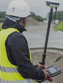
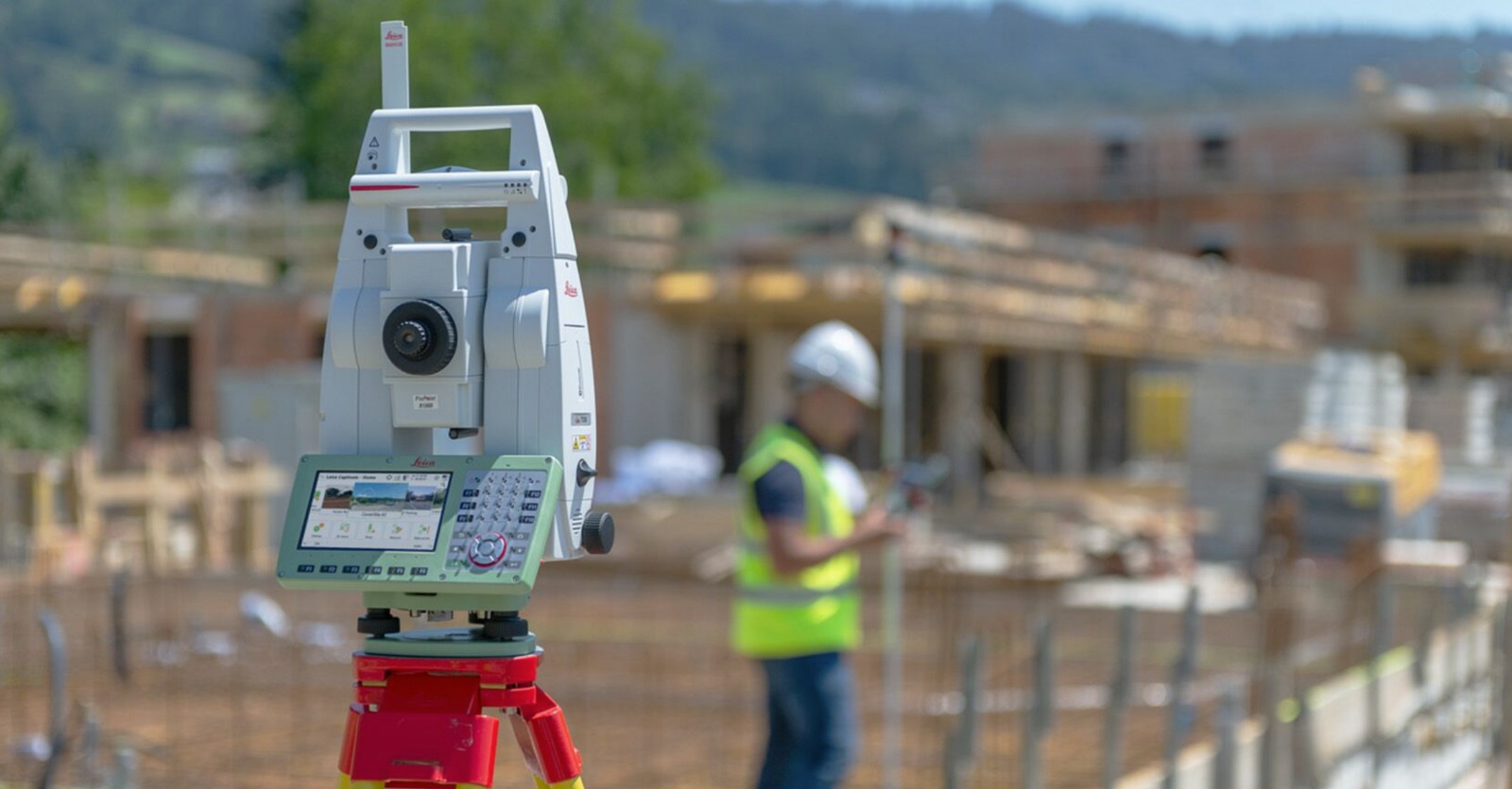
Expert topographic surveys using state-of-the-art equipment for precise terrain mapping, contour analysis, and site planning.

Measured Building Surveys

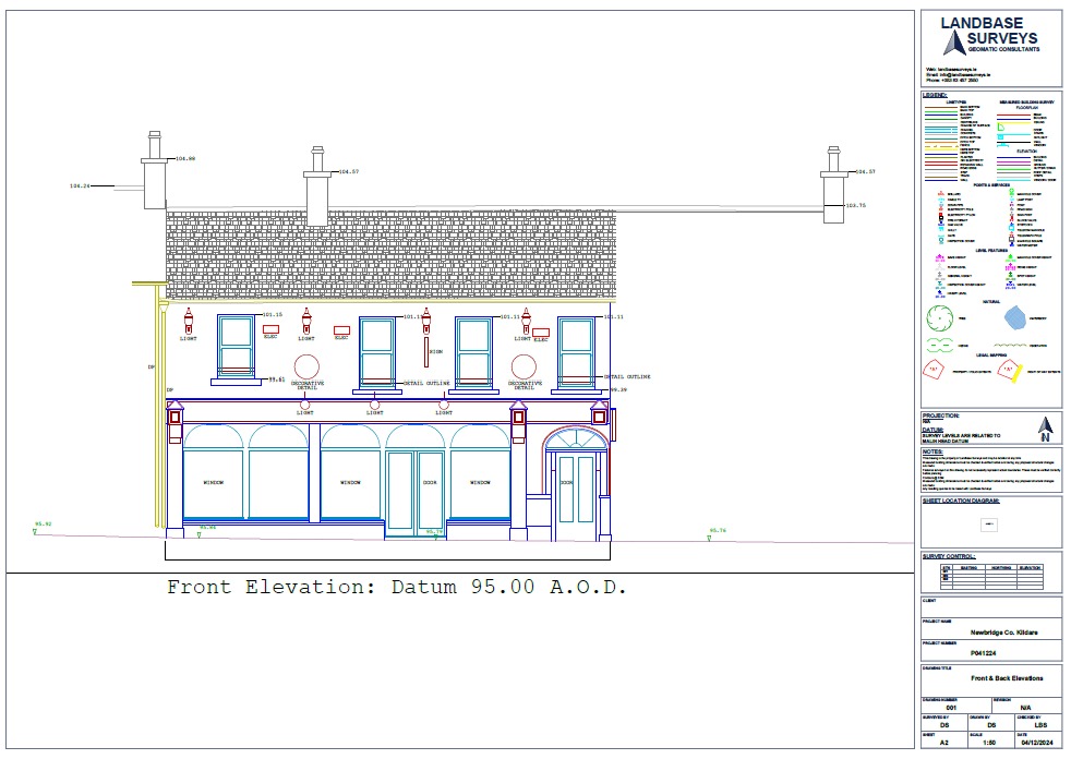
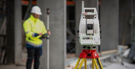
Detailed architectural and structural measurements for existing buildings, providing accurate floor plans, elevations, and sections.

Construction Set-Out

Lorem ipsum dolor sit amet, consectetur adipiscing elit, sed do eiusmod tempor incididunt ut labore et dolore magna aliqua.

AS Built & Validation

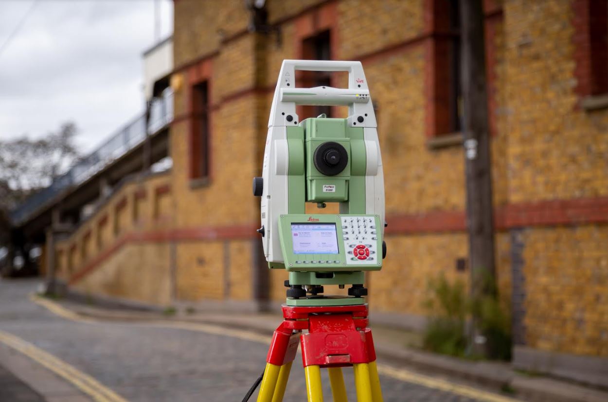
Independent verification surveys to ensure construction accuracy and compliance with design specifications.

Legal Property Mapping

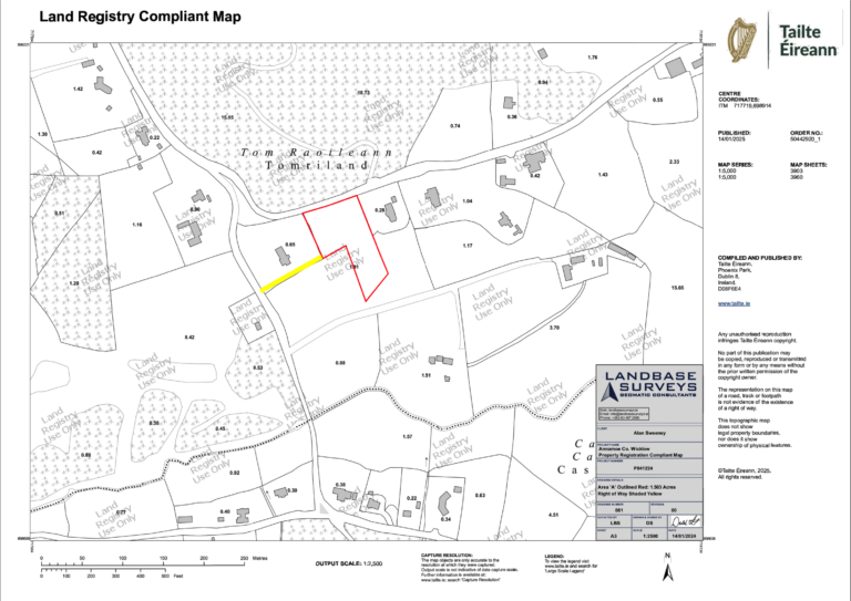
Comprehensive property boundary documentation and mapping services for legal purposes, including boundary disputes, property transfers, and planning applications.

GIS Databasing

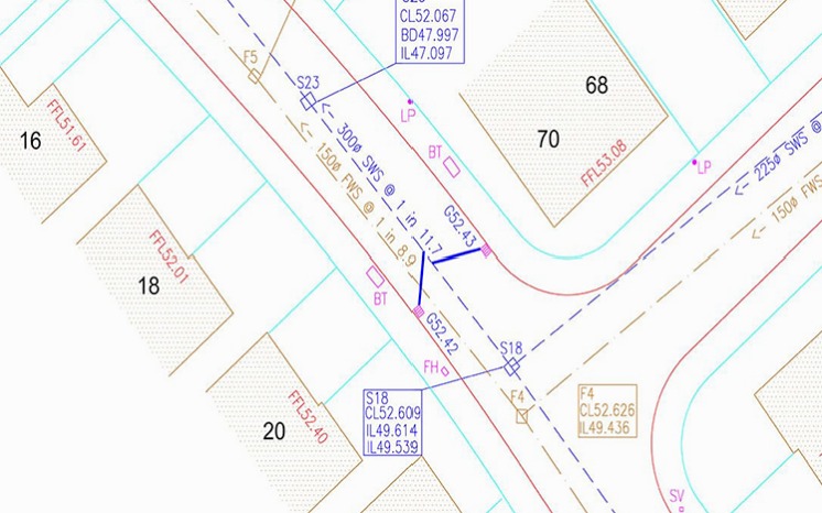
Advanced geographical information system solutions for data management and spatial analysis. We create custom GIS databases and mapping solutions to help organizations make informed decisions .

Project Management

Expert oversight of surveying projects from inception to completion. Our experienced project managers ensure efficient coordination, quality control, and timely delivery of all surveying services.

Training and Mentoring

Professional development programs in modern surveying techniques and technologies. We offer comprehensive training for surveyors, engineers, and technical staff to enhance their skills.

Air Drone Survey & Mapping

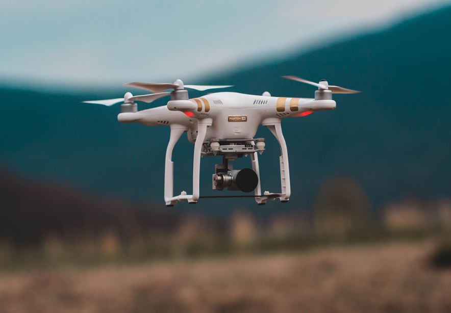
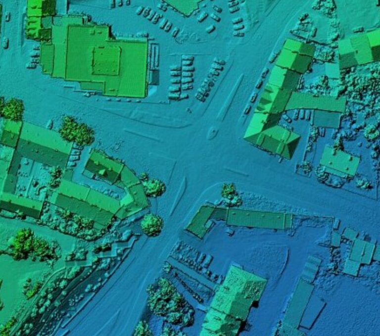
Drone mapping and surveying is a revolutionary service that harnesses the power of unmanned aerial vehicles (UAVs) to capture high-resolution aerial data for mapping, surveying, and inspection purposes. 

3D Laser Scanner

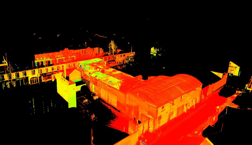
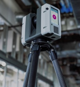
Whether you're mapping a building, designing complex structures, or conducting detailed surveys, 3D laser scanners offer an invaluable tool for creating accurate, data-rich models that streamline workflows, reduce errors, and enhance decision-making processes. Our advanced scanning services ensure you get precise, reliable results tailored to your specific needs.

Industries

Industries We Serve

Our expertise spans across multiple sectors, providing specialized surveying solutions that address the unique challenges and requirements of each industry. With over two decades of experience, we understand the specific needs of our diverse client base.

Architects & Engineers

Supporting architectural and engineering excellence with precision survey data. Our comprehensive surveying solutions enable informed design decisions, validate existing conditions, and ensure compliance with building regulations.

Real Estate Developers

Empowering property development projects with accurate site information and detailed surveys. From initial site assessment to final construction validation, we provide developers with crucial data for planning applications,  and project execution.

Construction Companies

Delivering precise set-out data and validation surveys throughout the construction process. Our expertise ensures accurate foundation positioning, structural alignment, and quality control. Right from the inception to the end of project.

Government Agencies

Supporting public sector projects with comprehensive surveying services. From infrastructure development to urban planning, we provide accurate spatial data essential for public works projects, environmental assessments, and regulatory compliance.

Homeowners & Property Buyers

Offering clarity and confidence in property-related decisions through detailed surveys. We provide accurate boundary surveys, topographic maps, and property feature documentation. Our services help homeowners resolve boundary disputes, improvements and lots more.

Legal Professionals

Supporting property-related legal matters with expert surveying services and documentation. We provide court-admissible survey reports, expert witness services, and detailed boundary documentation. Our precise surveys help resolve property disputes, support planning applications, and facilitate property transactions.

Our Gear

Technology and Equipment

Surveying Equipment

  • Total Stations
  • GPS & GNSS Receivers
  • 3D Laser scanners
  • UAVs (Drones)

Software Tools

  • CAD: AutoCAD, Civil 3D
  • GIS: ArcGIS, QGIS
  • Photogrammetry: Pix4D, Agisoft Metashape
  • Point Cloud Processing: CloudCompare, ReCap

Total Station

GPS GNSS Receiver

Laser Scanner

UAV Drone